Understanding Barbados’ Sailing Microclimate
The Caribbean archipelago presents a complex array of weather systems, but Barbados occupies a uniquely advantageous meteorological position. Situated at 13°N, 59°W, the island lies roughly 100 miles east of the primary Windward Island chain. This isolated eastern placement means Barbados intercepts the Northeast Trade Winds before they encounter any other terrestrial topography. These consistent breezes, typically blowing at a steady 10 to 20 knots, provide natural, reliable propulsion for sailing vessels and maintain a highly stable ambient air temperature. Daily highs average 30°C (86°F), while nighttime lows rarely dip below 24°C (75°F). Such thermal consistency ensures that the primary sailing season extends across all twelve months of the calendar year.
Because the island intercepts the Atlantic swells on its eastern coastline, the western shoreline—affectionately known as the Platinum Coast—enjoys significant leeward protection. The island’s central limestone ridge acts as a physical barrier against the prevailing eastern winds, resulting in the calm, glass-like surface conditions heavily prized by commercial marine operators. This stark contrast between the turbulent Atlantic east and the tranquil Caribbean west dictates all maritime tourism routes. Before planning a day on the water, captains rely on the precise daily marine forecasts issued by the Barbados Meteorological Services to monitor any unexpected thermal troughs or pressure drops.
Water temperatures around the island are equally reliable, fluctuating merely a few degrees between 26°C (79°F) in February and 29°C (84°F) in late August. Thermal exposure is not a concern for swimmers, rendering bulky wetsuits entirely unnecessary for daytime excursions. Whether you choose to book a comprehensive 5-Hour Small-Group Catamaran Cruise from Bridgetown in January or a mid-summer sail in July, the fundamental oceanography remains incredibly inviting.
Dry Season vs. Hurricane Season
When selecting your travel dates, understanding the dichotomy between the Bajan dry season and the official Atlantic hurricane season is crucial. While the marine climate is generally forgiving, these distinct meteorological periods dictate everything from crowd density and pricing to the specific navigational routes captains choose to take.
The Peak Dry Season (December to April)
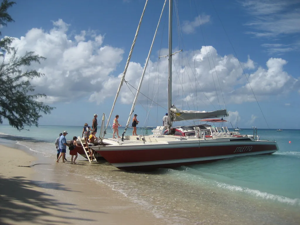
The winter months constitute the undisputed peak season for Barbadian maritime tourism. During this window, precipitation drops significantly, humidity levels fall to their annual minimums, and the skies offer unbroken azure clarity. The Northeast Trade Winds often peak during these months, consistently delivering 15 to 25 knots of wind. For sailing purists, this is the optimal time to be on the water. The dual-hull structure of a catamaran provides exceptional stability, allowing these vessels to slice through the lively Caribbean chop with minimal roll.
Because these conditions are globally recognised as ideal, demand for premium vessels skyrockets. Securing a spot on a highly-rated Barbados Catamaran Turtle and Shipwreck Snorkelling Cruise requires booking weeks, if not months, in advance. This is particularly true for travellers seeking to explore the premier Best Spots for Catamaran Cruises along the West Coast during the busy holiday weeks of late December and early January.
The Green Season (June to November)
Often inaccurately dismissed as a period of perpetual storms, the summer and autumn months are characterised by higher humidity, warmer ocean temperatures, and passing tropical showers. These showers are typically heavy but brief, rarely disrupting a five-hour daytime itinerary. However, this period aligns with the Atlantic hurricane season. While Barbados’ extreme eastern location traditionally spares it from the main hurricane belt, the island is not entirely immune to cyclonic activity.
A stark reminder of this vulnerability occurred on July 1, 2024, when Hurricane Beryl—an unusually early Category 4 storm—passed directly south of the island. The resulting storm surge caused unprecedented structural damage to the Bridgetown Fisheries Complex and sank numerous private and commercial vessels moored at the facility. Authorities and operators now monitor tropical waves with heightened vigilance, relying on data from the National Hurricane Center to issue prompt small craft advisories and protect both passengers and fleets.
Wind Speed & Sea Condition Logistics
To fully appreciate what your chosen sailing day will entail, it is helpful to understand how local captains evaluate the wind and waves. The maritime industry universally employs the Beaufort Wind Force Scale. In Barbados, typical daily conditions hover between Force 3 and Force 4, providing enough kinetic energy to fill the sails without compromising passenger safety or comfort. When the wind escalates past 21 knots, captains must make critical decisions regarding their route, often bypassing exposed northern points to remain within the sheltered anchorages of the central and southern parishes.
| Beaufort Scale | Wind Speed (Knots) | Typical Barbados Sea Conditions | Impact on Catamaran Experience |
|---|---|---|---|
| Force 2 (Light Breeze) | 4 – 6 knots | Glassy, calm surface. Minimal wave action. | Perfect for nervous sailors. Relies primarily on engine power rather than sails. |
| Force 3 (Gentle Breeze) | 7 – 10 knots | Small wavelets, crests begin to break. | Ideal snorkelling conditions. Sails are hoisted, smooth and stable cruising. |
| Force 4 (Moderate Breeze) | 11 – 16 knots | Small waves becoming longer. Frequent white horses. | The classic Bajan sailing day. Excellent propulsion, moderate hull spray, high excitement. |
| Force 5 (Fresh Breeze) | 17 – 21 knots | Moderate waves taking a pronounced long form. | Vessel begins to pitch. Snorkelling locations restricted to highly sheltered bays. |
| Force 6 (Strong Breeze) | 22 – 27 knots | Large waves begin to form. Extensive white foam crests. | Small Craft Advisories often issued. High likelihood of itinerary modifications or cancellations. |
“Once the Northeast Trade Winds push past 21 knots into Force 6 territory, the kinetic transfer into the coastal shelf generates swells exceeding 2.5 metres. While commercial catamarans are structurally capable of handling these seas, passenger comfort declines sharply. If you are prone to motion sickness, always verify the wind forecast and consult our Equipment & Safety Guide for effective pharmacological and natural remedies before stepping onto the pontoon.”
Marine Operations Directorate
Protected Coastal Zones
The geographical layout of Barbados naturally dictates the viability of commercial sailing routes. The turbulent Atlantic Ocean batters the eastern parishes of St. Joseph and St. Andrew, creating a rugged, wave-swept coastline that is entirely unsuitable for leisure cruising. Consequently, the entirety of the catamaran fleet operates on the sheltered western and south-western corridors. This leeward advantage ensures that even when the trade winds are howling across the island’s central plains, the coastal waters of St. James and St. Michael remain remarkably tranquil.
Carlisle Bay serves as the epicentre of this protected marine environment. Nestled in a deep crescent on the south-western edge of Bridgetown, the bay naturally deflects open-ocean currents. This creates a highly predictable, low-energy marine environment that acts as a haven for both sea turtles and novice swimmers. Navigating further north along the Platinum Coast toward Holetown and Speightstown, the coastal shelf drops off gradually, dissipating the kinetic energy of deep-water swells long before they reach the catamaran anchorages.
Best Times of Day: Morning Snorkelling vs. Sunset Cruises
Beyond selecting the right month, identifying the optimal time of day is paramount to crafting your ideal itinerary. Operators generally divide their schedules into two distinct windows: the energetic, sun-drenched morning departures and the atmospheric, relaxed late-afternoon sails. Each window interacts differently with the local microclimate, altering the sensory experience of the ocean.
Morning Light & Maximum Visibility
Morning cruises typically depart between 9:00 AM and 9:30 AM, capitalizing on the sharp, direct angle of the Caribbean sun. This period is undisputed in its superiority for underwater visibility. Between 8:00 AM and 10:30 AM, solar rays penetrate the water column directly, illuminating the vibrant coral formations and historic scuttled vessels with absolute clarity. According to the Coastal Zone Management Unit, water particulate suspension is often at its lowest in the early morning before heavy motorized traffic stirs the sandy seabed.
If your primary objective is Snorkelling the Shipwrecks, such as the shallow Berwyn wreck in Carlisle Bay, the morning itinerary is essential. The direct light allows underwater photographers to capture the vivid hues of the marine life without relying on heavy artificial strobes. To secure this prime lighting window, an excursion like the Barbados Catamaran Turtle Snorkel with Lunch and Open Bar ensures you are anchored at the marine park during peak visibility hours.
The Golden Hour & Twilight Serenity
Afternoon departures, which generally cast off around 3:00 PM, offer a fundamentally different atmosphere. As the sun begins its descent toward the western horizon, the intense midday heat dissipates, replaced by a cooler, highly comfortable ambient temperature. The wind often begins to soften during these hours, resulting in an exceptionally smooth sail back to port. While deep-water snorkelling visibility decreases as the sun lowers and shadows lengthen across the seabed, the surface conditions become idyllic for relaxed, floating swims.
The true draw of the afternoon itinerary is the meteorological phenomenon of the golden hour, which commences roughly 45 minutes prior to sunset. The sky transforms into a canvas of deep ochre, violet, and crimson. If you are celebrating a milestone or seeking a romantic atmosphere, booking a Barbados Sunset and Snorkelling Catamaran Cruise is unparalleled. For a deeper dive into the specific aesthetics of these evening voyages, consult our dedicated guide to The Magic of a Bajan Sunset on the Water.
The morning sun illuminates the ocean floor with crystalline precision, while the evening twilight cools the air and transforms the Caribbean Sea into a mirror of molten gold. Your choice dictates the very soul of the voyage.
Weather-Related Cancellations & Operator Policies
Despite the generally pristine conditions, responsible captains will not hesitate to ground their fleets if the meteorological data suggests compromised safety. Standard industry protocols are rigorously enforced across all major operators. While rain alone is rarely sufficient cause for cancellation—most modern catamarans feature extensive covered saloons—electrical storms, lightning risks, and high-energy ground swells dictate immediate itinerary suspensions.
It is vital to distinguish between a captain’s weather cancellation and a guest-initiated cancellation. If the local port authority issues a small craft warning and the operator cancels the voyage, guests are universally offered a rescheduled date or a full refund. Conversely, if a guest decides not to attend because the sky is overcast, standard punitive cancellation policies apply. Always review the specific terms of your booking carefully; highly sought-after operators often maintain strict 24-to-48-hour cancellation windows to manage their waiting lists efficiently.
Conclusion: Choosing Your Perfect Time to Sail
Selecting the best time to embark on a catamaran cruise in Barbados ultimately requires balancing your specific priorities against the island’s subtle meteorological rhythms. If your primary goal is flawless underwater visibility for examining the marine reserves, prioritize a morning departure between January and April, when the dry season provides maximum solar penetration and minimal agricultural runoff.
Conversely, if budget constraints and crowd avoidance are paramount, the shoulder months of May and November offer an exceptional compromise. During these transition periods, the trade winds remain reliable, the ocean temperatures are highly inviting, and the density of commercial vessels anchored in Paynes Bay significantly decreases. For those travelling during the height of the summer green season, rest assured that the passing afternoon showers serve only to cool the deck, rarely impeding the sheer joy of sailing the Platinum Coast.
Before finalizing your reservation, we highly recommend reading our guide on Private Charters vs. Group Excursions to ensure the vessel size and guest capacity align with your expectations. Regardless of the month you choose, the steady winds, warm waters, and sheltered western coastline guarantee that a Barbadian sailing adventure remains one of the premier maritime experiences in the Caribbean basin.